Solar Mapping of Portland State University
Project Description: Finding the Optimal Full Sun Ornamental Container Placement Using LiDAR Data and ESRI’s ArcPro Solar Radiation Toolset
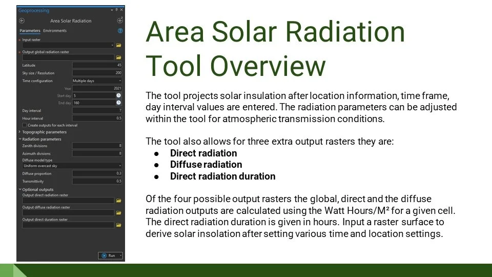
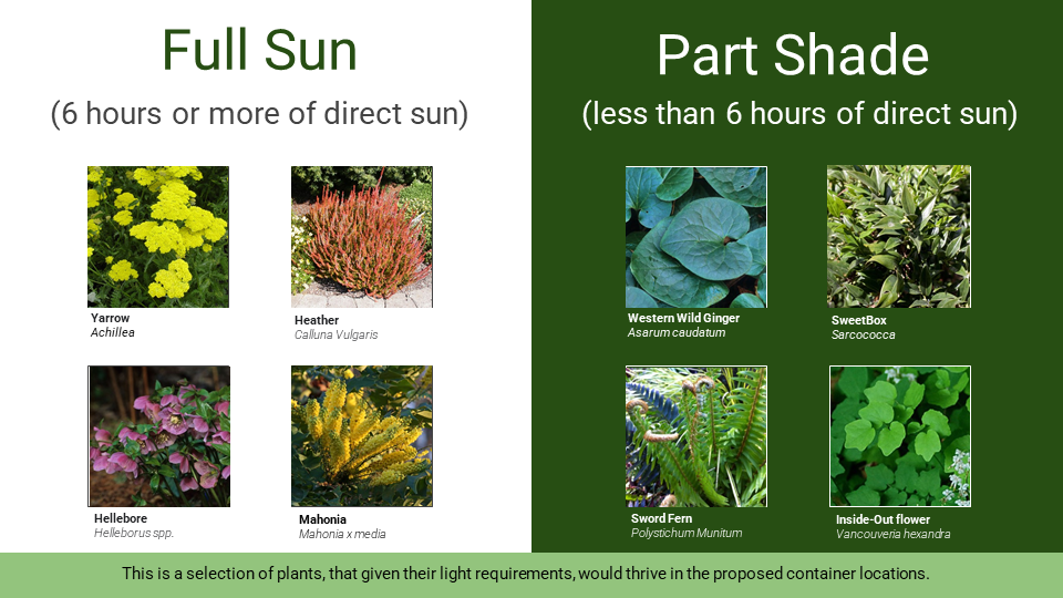
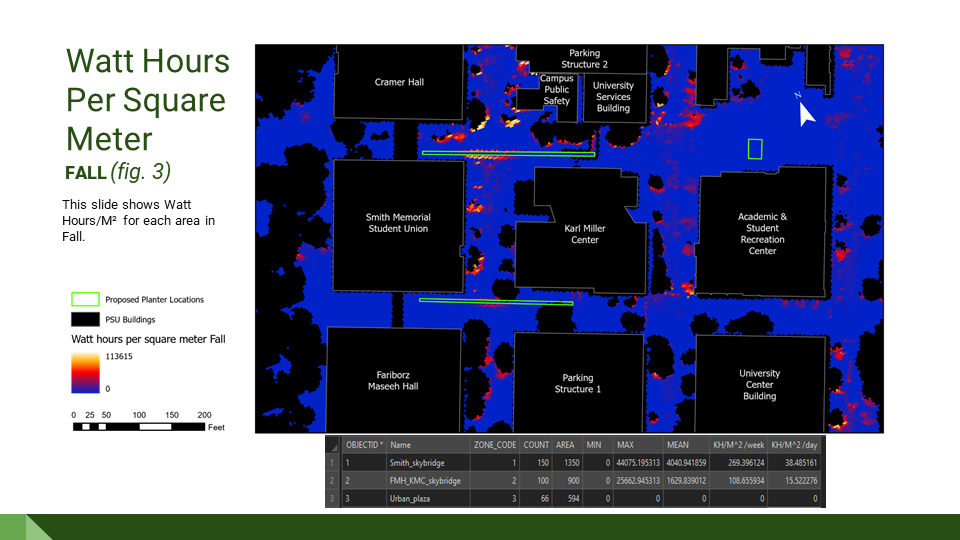
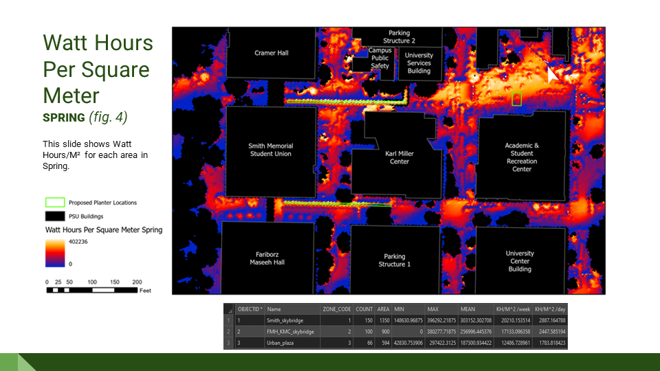
Portland State University (PSU) is a very urban campus with limited sunlight because of it’s tall buildings and dense tree canopy. This creates a challenging environment for ornamental plants to survive. By identifying the solar intensity across campus facilities staff can locate the ideal locations for ornamental plants. Different plants require varying levels of solar intensity. This analysis results in a map of proposed planter locations and their solar intensity values which allows staff to match ornamental plants to those locations. For this study campus leadership in the past asked if it would be possible to add some above ground planting containers at the proposed locations selected in this study. Using a 3 foot digital elevation model (DEM) and a 3 foot digital surface model (DSM) based on ground point and first return LiDAR data I clipped PSU’s campus and some surrounding buildings. The DEM and DSM were supplied by Metro’s Regional Land Information System. I then used ESRI’s solar radiation tool kit to map the effects of the sun over PSU for two distinct planting seasons, Fall (Nov. to March) and Spring (end of March to end of June). To identify the sun’s effect on campus I ran the Area Solar Radiation tool in ArcGIS Pro. With this analysis I was able to confirm full sun (6+ hours) of ornamental plants will succeed at the proposed locations on campus. Yarrow, Heather, Mahonia and Hellebore should all do well on both Sky Bridges based on the amount of sun they receive.
Tools Used: ArcPro, Solar Radiation Tool
Skills Used: Spatial Analysis, LiDAR, Data Collection

Conclusion
Urban Plaza could work for full sun plants in the Spring if the proposed area I chose was more north as to not capture the surrounding building’s shadow.
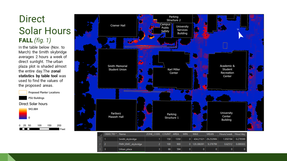
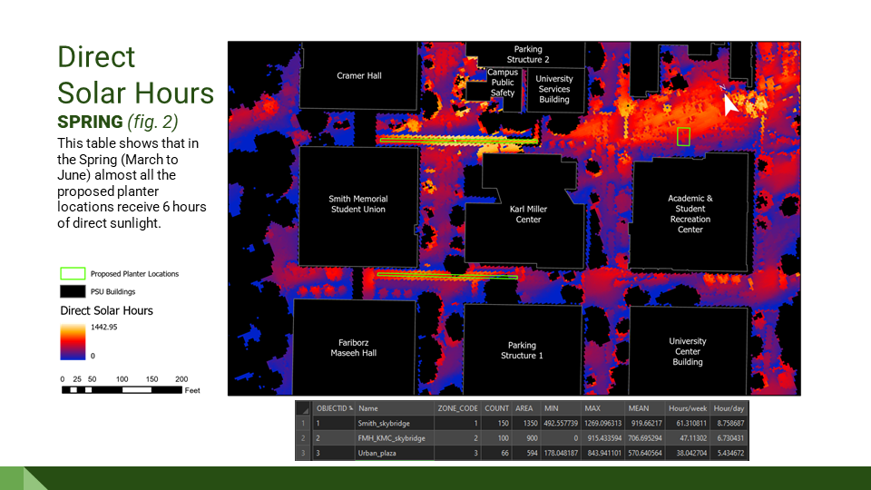
The sky bridges are good for full sun plantings in Spring and bad for Fall plantings.
This report only showed direct solar transmission. Diffuse and reflective transmission were left out because this causes the viewer to believe that Urban Plaza receives no sunlight during the Fall. In reality it receives light from the reflected glass of the buildings and scattered light in the atmosphere, however it’s minimal.
Credits
Data Sources
Metro 2019 LiDAR Three foot DEM/DSM Data Set
PSU Planning Department Building Basemaps
Plant Photos
greatplantpicks.org
Portlandnursery.com